CP1: Esztergom, Hungary – km 395
CP2: Ptuj, Slovenia – km 756
CP3: Mantua, Italy – km 1324
CP4: Nice, France – km 1888
CP5: Mont Ventoux – cycling on the moon – km 2184
CP6: Cirque de Navacelles – km 2402
CP7: Col du Tourmalet – Eugene Christophe incident parkour – km 2817
CP8: Mallos de Riglos – the orange towers – km 3030
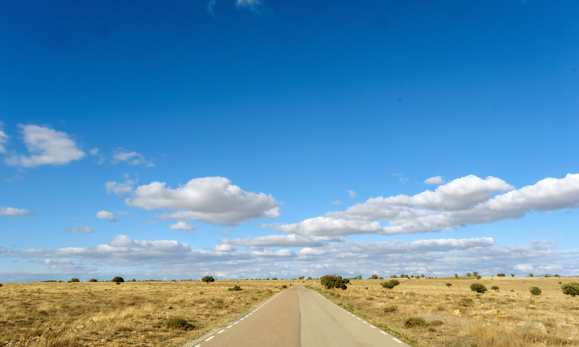
CP9: Terra de Gigantes parkour in La Mancha – km 3575
CP10: Pico del Veleta – km 3952
CP11: Tarifa – km 4384
CP 1: Esztergom, Hungary
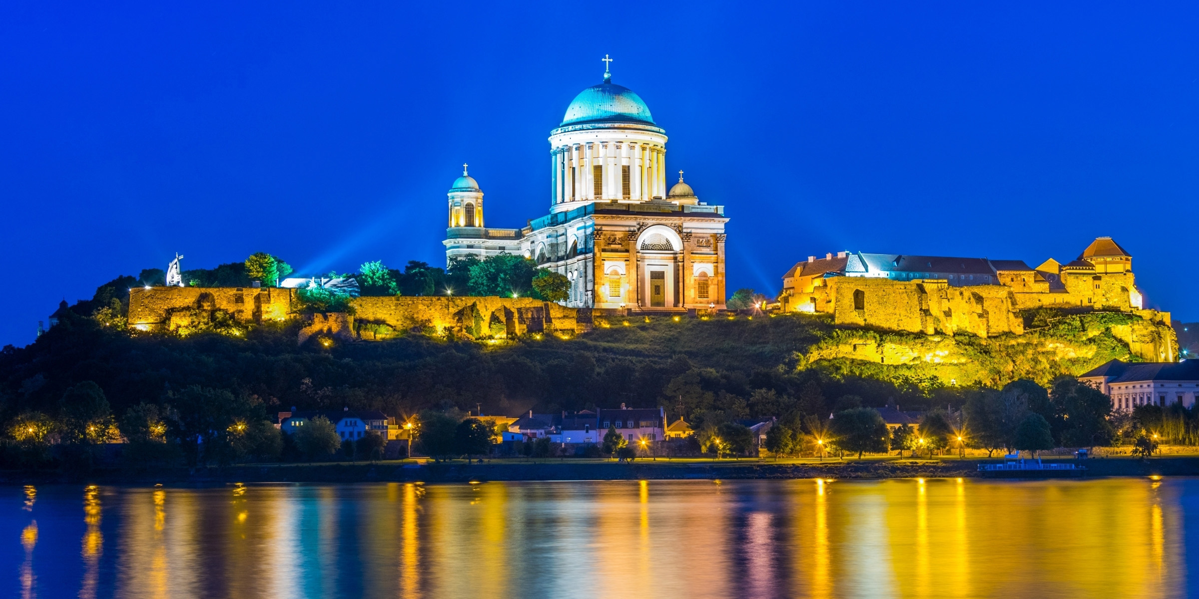


Esztergom is an important city in the history of Hungary: the founder of the state, the King of Hungary, Saint Stephen, was born and also crowned here. The town, situated in the picturesque region of the Danube Bend was the first capital of Hungary.
Crossing the bridge over the Donau river from Slovakia to Hungary at the Danube bend, you will see the eye-catching castle and the monumental Esztergom Basilica which is the largest church and the tallest building in Hungary.
The building of the present church took place on the foundation of several earlier churches built on the castle hill in Esztergom in the Middle Ages. The first was built by Stephen I of Hungary between 1001–1010 (as the original Saint Adalbert church), the first cathedral in Hungary, which was burned down at the end of the 12th century. It was rebuilt, and even survived the Mongol invasion of Hungary.
However, in 1304, Wenceslaus III, a probable candidate for the Hungarian throne, sacked the castle and the church. It was repaired in the following years. The archbishops of the 14th and 15th centuries made the church more ornate and added a huge library, the second most significant one in the country. It was ruined again under Turkish rule, in 1543. In 1820, the Archdiocese was restored and archbishop Sándor Rudnay decided to restore Esztergom’s status as the mother church of the country.
Esztergom is also the cradle of Hungarian bath culture where the first public bath was established as well as the first indoor swimming pool outside of Budapest opened its doors here.
CP 2: Ptuj, Slovenia
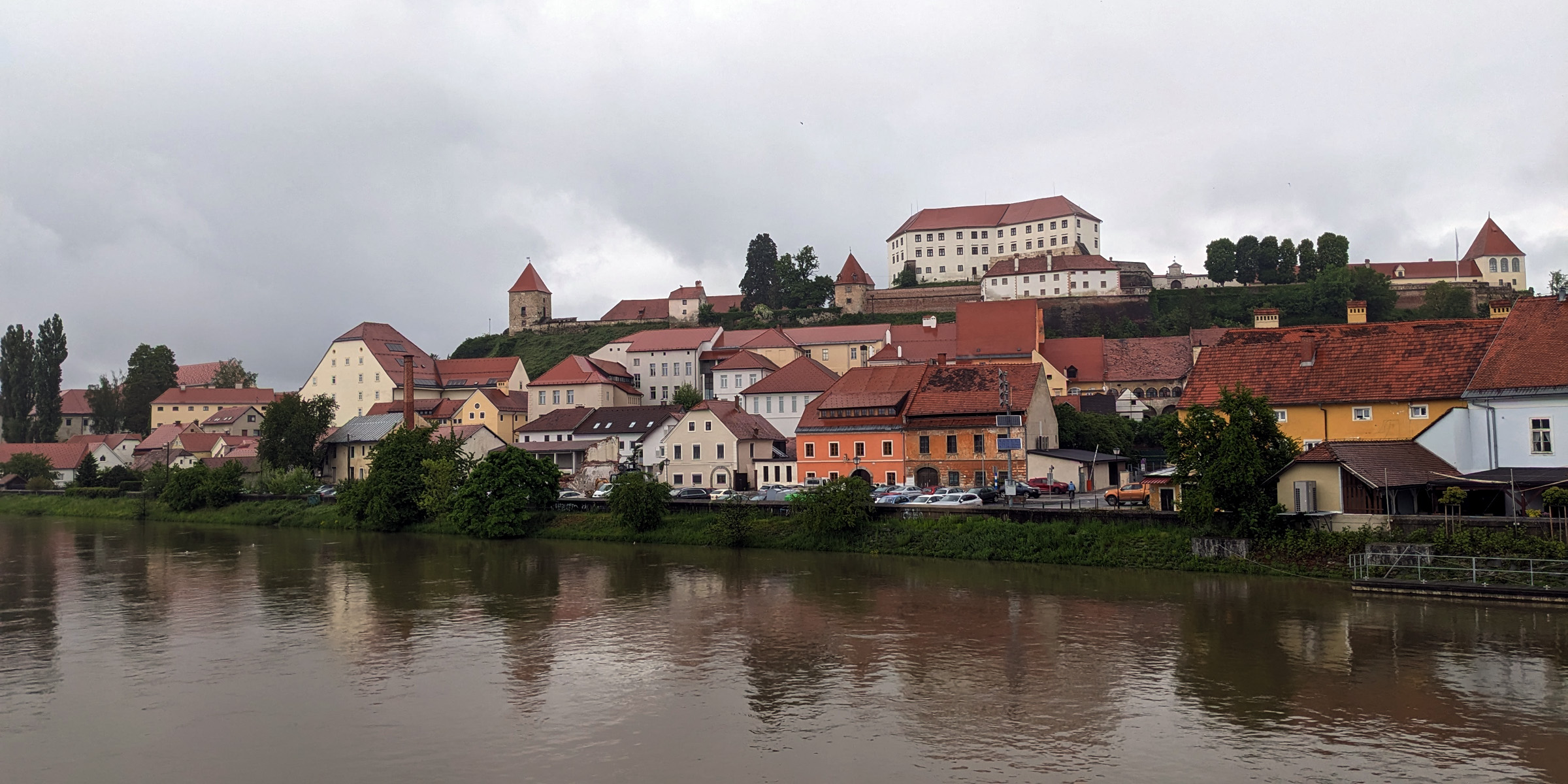


Through vineyards and hills, the route will take the riders to Ptuj, the oldest city in Slovenia and one of the oldest in Europe. Ptuj, known for its rich culture and historical significance, awaits riders as the second checkpoint on the route to Tarifa.
The roots of Ptuj’s settlement can be traced back to the Stone Age, providing evidence of human habitation in the area. During the Late Iron Age, the city was inhabited by Celts, further adding to its historical importance.
Ptuj takes center stage during a ten day long spring carnival known as Kurentovanje or Korantovanje, which is an ancient Slavic pagan celebration of spring and fertility.
In addition to its cultural heritage, Ptuj is home to Slovenia’s oldest winery, Ptujska Klet, established in 1239. This historic winery proudly preserves the oldest known Slovenian wine, dating back to 1917.
Before reaching Ljubljana, riders will stop on the bridge over the Drava River to take a mandatory photo with a view of the majestic Grad Ptuj castle from the 11th century, located atop a picturesque hill.
CP 3: Mantua, Italy
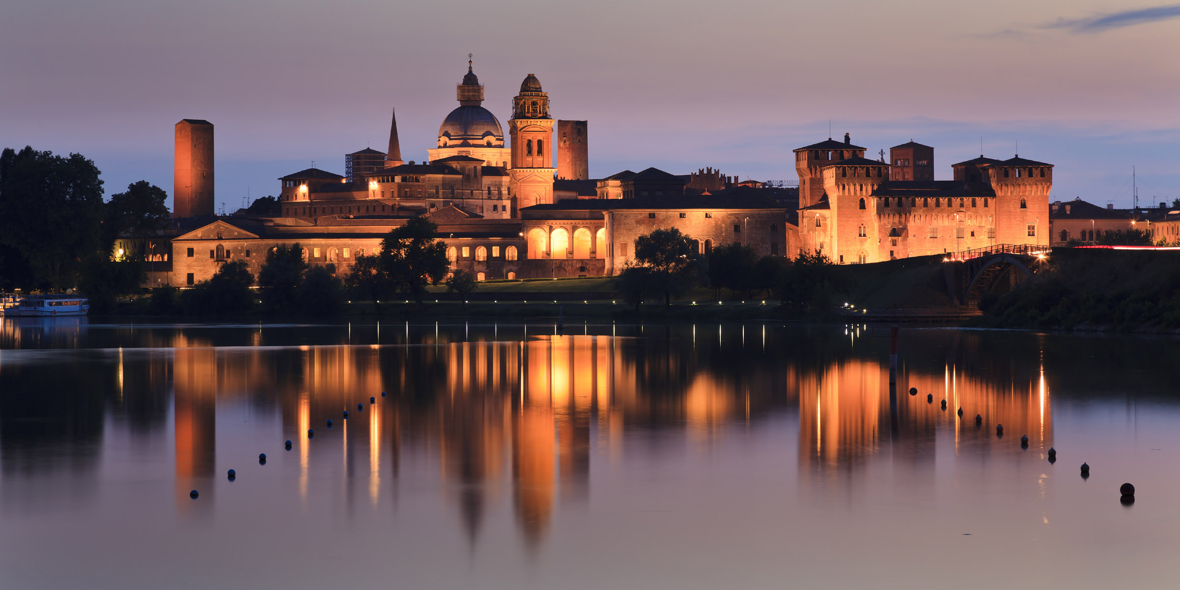


Mantua was an island settlement that was first established about the year 2000 BC on the banks of River Mincio, which flows from Lake Garda to the Adriatic Sea and is surrounded on three sides by artificial lakes, created during the 12th century as the city’s defense system. The cultural value of Mantua is outstanding, with many of Mantua’s patrician and ecclesiastical buildings being uniquely important examples of Italian architecture. Just to mention Basilica di Sant’Andrea which holds a vile of holy blood that was identified as authentic almost 1000 years ago. Built way back in the 15th Century this beautiful basilica took over 300 years to complete!
Mantua has been the setting for several of Italy’s most beloved works of art and artists. Mantua influenced Giuseppe Verdi’s opera Rigoletto, Shakespeare’s Much Ado About Nothing, and Romeo and Juliet, and was the birthplace of Virgil. Over the years, famous visitors to the town such as Peter Paul Rubens, Giulio Romano, and Petrarch enriched its history, and their traces can still be seen in Mantua today.
CP 4: Nice, France
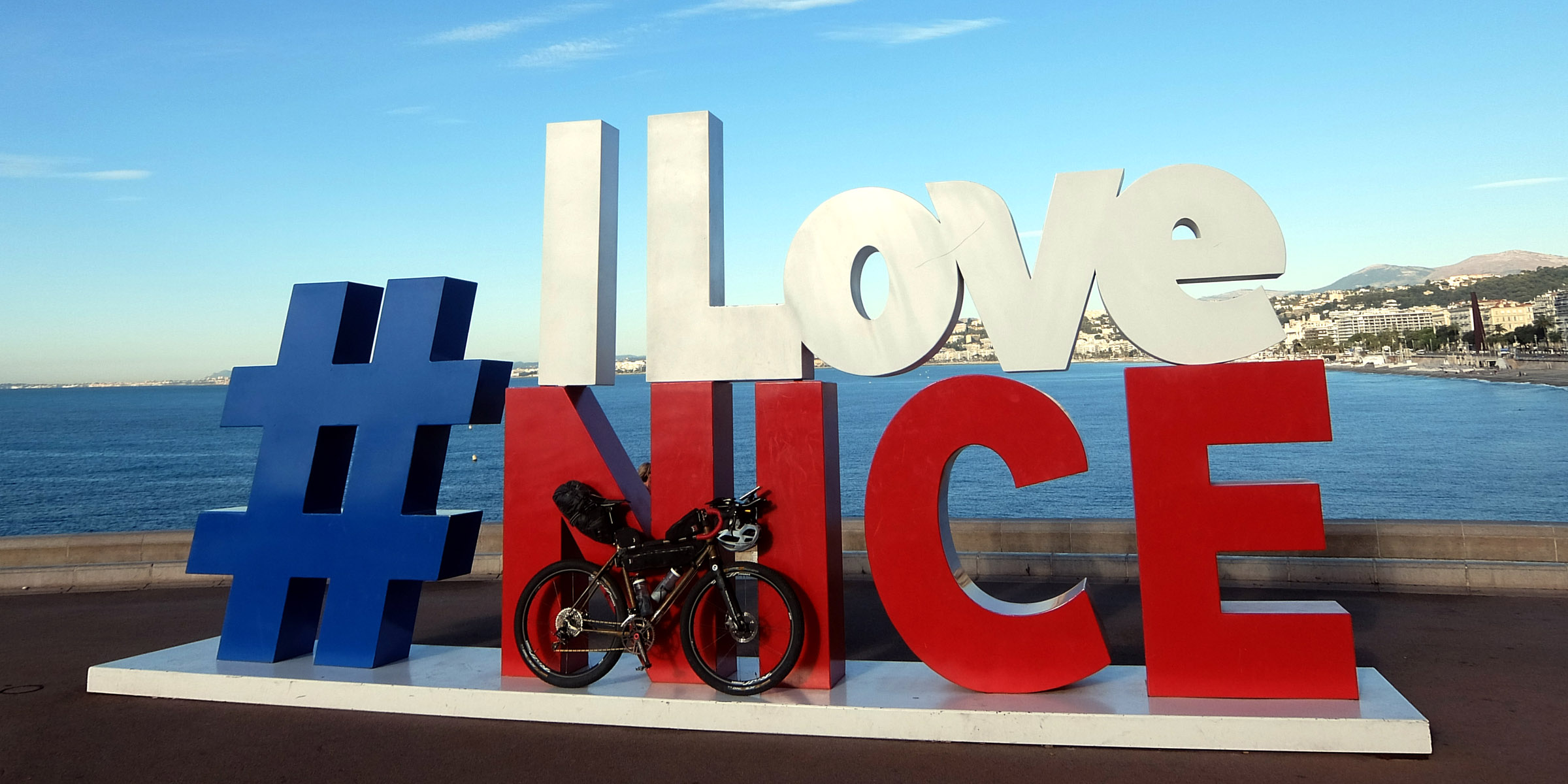


Nice was founded in the 4th century BC by the Greeks and named Nike after the goddess of Victory. Conquered by the Romans during the 1st century CE, it became a busy trading station. The city is nicknamed Nice la Belle as the legend says even Adam and Eve, after being expelled from paradise, were brought here by benevolent angels who decided that the beauty of this place would make the punishment more bearable.
Nice Hosts a Carnival every year, around mid-February, this carnival can be dated back as far as 1294. Every day at noon, you can hear a cannon shot in Nice. This tradition dates back to 1860.
At that time, Sir Thomas Coventry and his wife were living in Nice. Because she was always late, he asked the mayor to shoot a daily noon shot from a cannon. Nice’s oldest restaurant opened in 1892, La Mason Baral. The iconic Blue Chairs of Nice, inseparable from Nice were an initiative of Charles Tordo, who lined them up in the 1950s. However, they were stolen, so the city had to chain them down together.
Nice has more traffic lights than any other city in France.
CP 5: Mont Ventoux – cycling on the moon
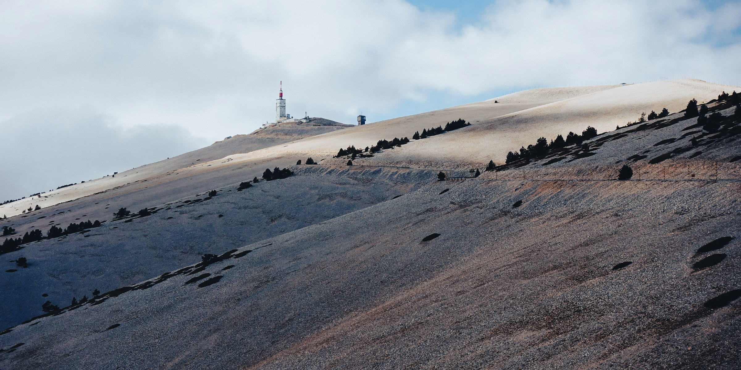


Mont Ventoux at 1,909m it is the highest mountain in the Provence region and has been nicknamed The Giant of Provence, Beast of Provence, and The Bold Mountain. From its summit, with it`s desolate mineral moonscape, the view is breathtaking. On a clear day, it is even possible to glimpse the Mediterranean Sea to the south and Mont Blanc to the north. As the name might suggest (vertex means windy in French), it can get windy at the summit, especially with the mistral; wind speeds as high as 320 km/h have been recorded.
Over the centuries the mountain was stripped of its forests for charcoal production, then timber for shipbuilding. From the 17th to 19th centuries a significant industry in the region was the selling of ice from Ventoux. For making sorbets and preserving dead bodies of course. Resembling a lighthouse, the distinctive red and white building at the top is a meteorological station. It was built in 1968. The building now is used to broadcast television signals as well as its original purpose.
The mountain can be climbed by three routes: south from Bédoin, northwest from Malaucène, and east from Sault. There is a special award that goes to cyclists who ride Mont Ventoux three times from each direction in one day.
Mont Ventoux is a regular Tour de France highlight. The Tour is ascending the mountain since 1951. In 1967, Tom Simpson, a British cyclist competing in the Tour de France, died on Mont Ventoux. A memorial to him has been erected on the mountain close to the spot where he died.
“The Ventoux is a god of evil, to which sacrifices must be made. It never forgives weakness and extracts an unfair tribute of suffering.” Roland Bart, cyclist and author.
CP 6: Cirque de Navacelles
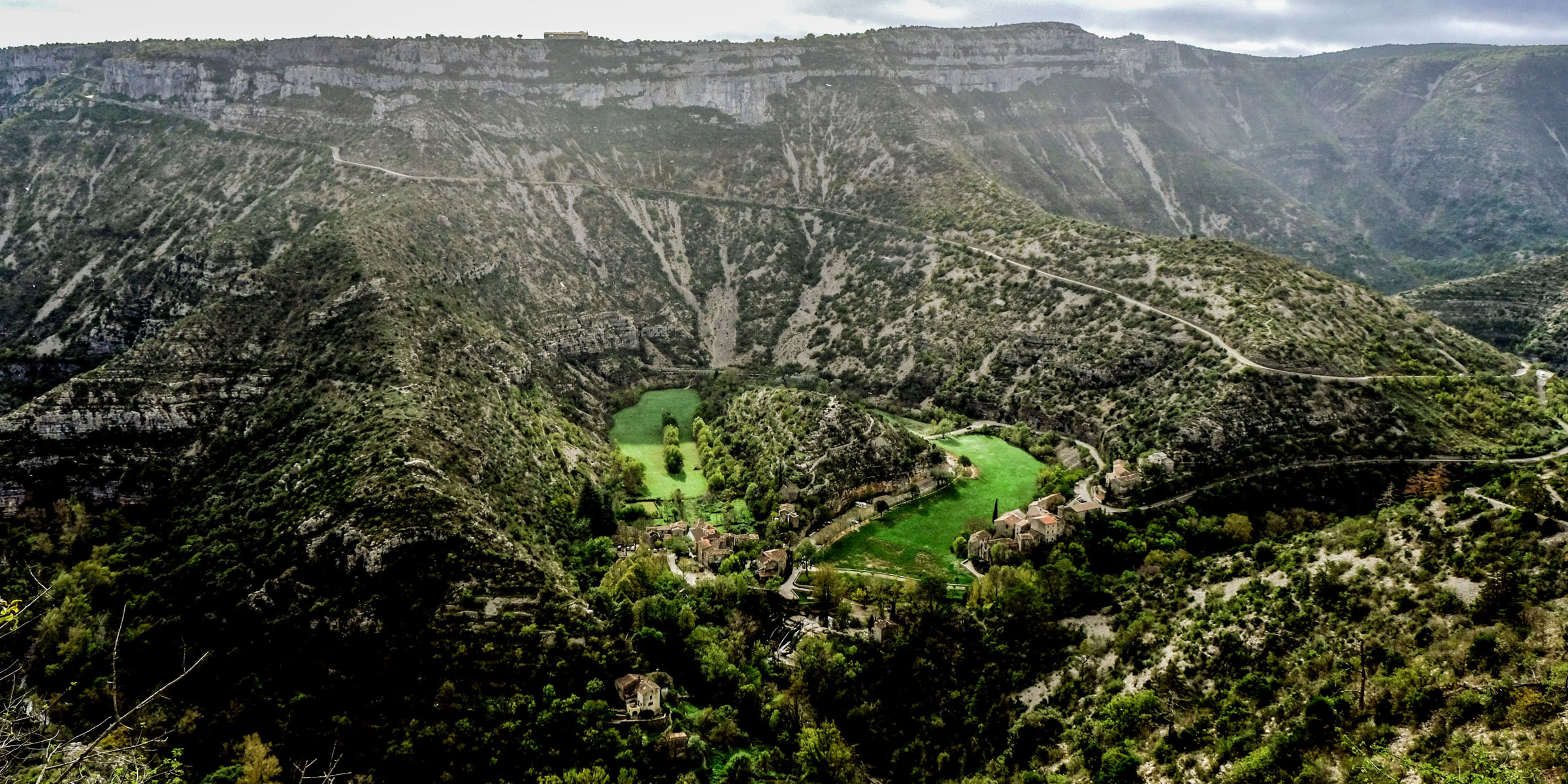


Cirque de Navacelles is one of the most remarkable natural sites in France. The valley was formed about 3 million years ago by glacial erosion. The Vis river then cut through the base of the valley, creating a horseshoe lake. The lake dried up and left behind clay and peat. Surrounded by the limestone plateau of the Causses and the Cevennes in the North, it’s officially classified as a ‘Grand Site de France‘. Some have given it the name “Rocher de la Vierge”, the locals prefer the nickname “Oyster”, based on its oblong shape. The cirque is very isolated; there are only a few small villages in the area. The nearest place is Millau.
There is a myth attached to the cirque. The crater is said to have been created by a hoofprint of the horse of Gargantua, father of Pantagruel, during his world trip. These figures were created in the 16th century by the French humanist François Rabelais, who taught medicine in nearby Montpellier.
CP 7: Col du Tourmalet – Eugene Christophe incident parkour
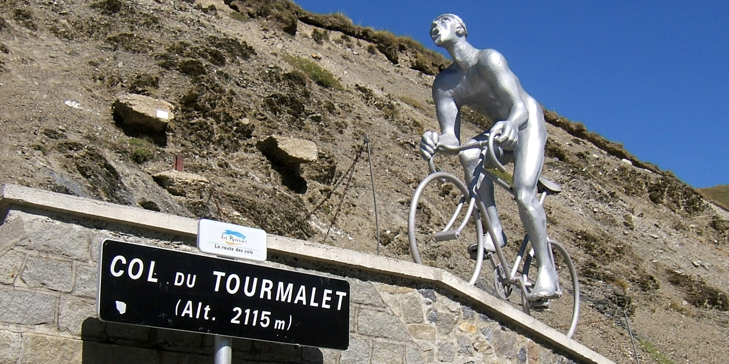
Tourmalet is the highest paved mountain pass in the French Pyrenees, with an elevation of 2,115m. The first cycling race passing through the Col du Tourmalet took place on August 18, 1902, called the “Touring Bicycle Competition” and was organized by the Touring Club de France.
In 1910 the Tour was looking for some innovation. TdF founder, Henri Desgrange, believed that a climb up the Tourmalet would be madness. Alphonse Steinès had the idea of doubling the focus on climbs in the Pyrenees. Steinès set out on a reconnaissance mission. However, the journey turned into a nightmare. He was forced to abandon his car and continue on foot through the snow-covered abyss. Lost and alone in the sub-zero temperatures for hours, the mission almost cost Steinès his life but did not deter him from immediately sending his iconic telegram to Desgrange that read: “Cross Tourmalet. Very good road. Perfectly feasible.”
The legendary climb has been part of the Tour de France race since and has been included in the race more than any other pass. The first rider over was Octav Lapize.
Eugène Christophe, in the 1913 Tour de France, after breaking his fork at the start of the descent of the pass, not allowed to take any outside help, he walked for fourteen kilometers to Sainte-Marie-de-Campan where he carried out his repair himself in the forge of Alexandre Torné. Eugène Christophe didn’t abandon the race that he should have won, showing a sublime example of willpower. The route will lead the riders to the statue of Eugene Christophe located 17km from the summit.
Christophe rode 11 Tour de France in total, without a single overall victory…
The pass is on the program for the 6th stage of the Tour de France 2023.
CP 8: Mallos de Riglos – the orange towers


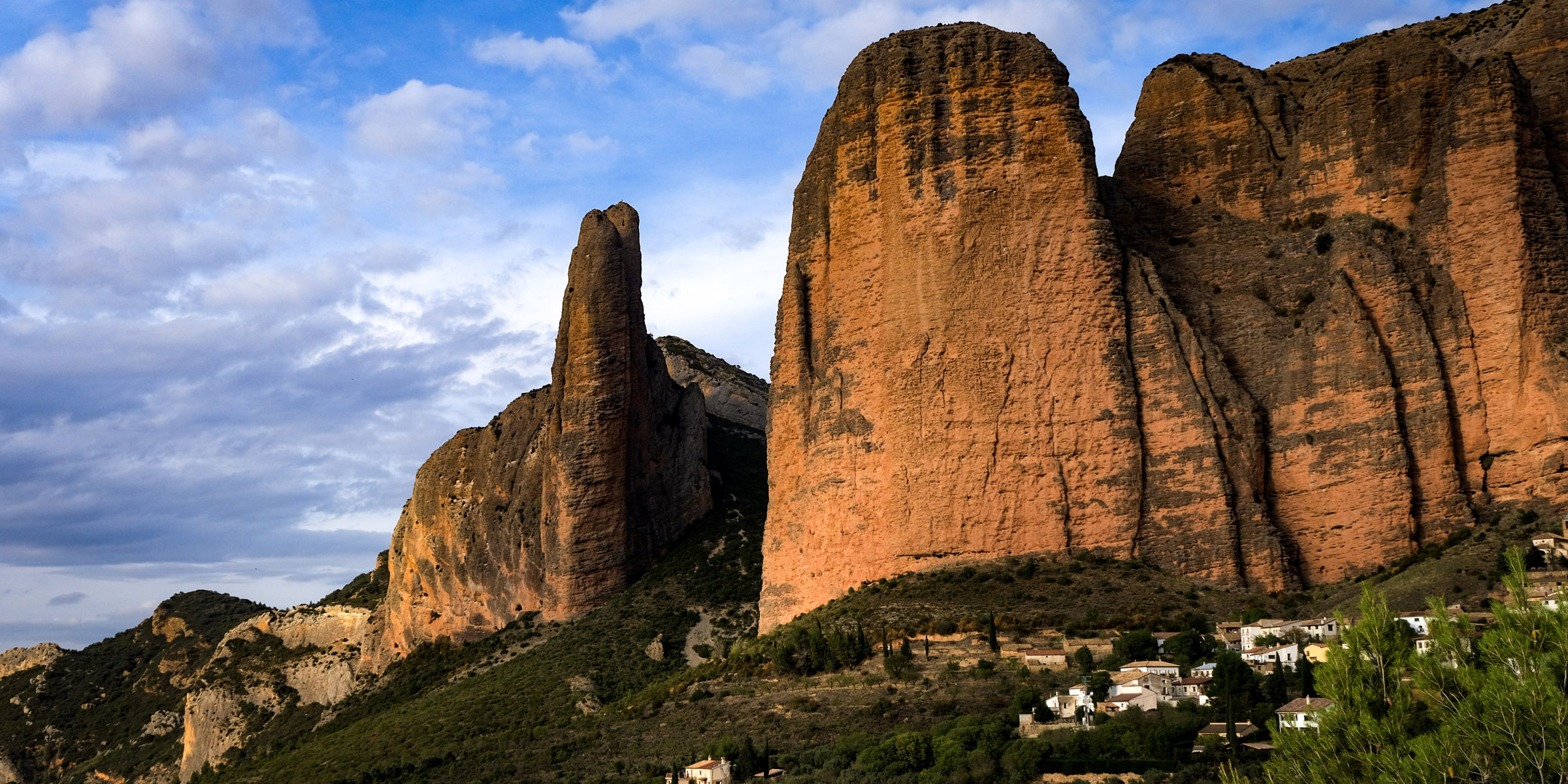
The Mallos de Riglos are huge natural sculptures up to 300m tall and are among the most spectacular landscapes in the Spanish Pre-Pyrenees.
They are made of pudding stone (rolled pebbles, welded together with cement). They are between 20 and 30 million years old. The red hues of the rock are produced by the oxidation of ferrous materials.
An old legend attributes to a witch the creation of mallos.
Her appearance and size frightened the neighbors and, tired of it, she raised the huge rocks and hid from everyone. Even today it is said on special days the witch leaves the Mallos when she believes that nobody sees her and walks around Riglos contemplating the beautiful place she has created.
You will be amazed at what wonder nature can give you.
CP 9: Terra de Gigantes parkour in La Mancha
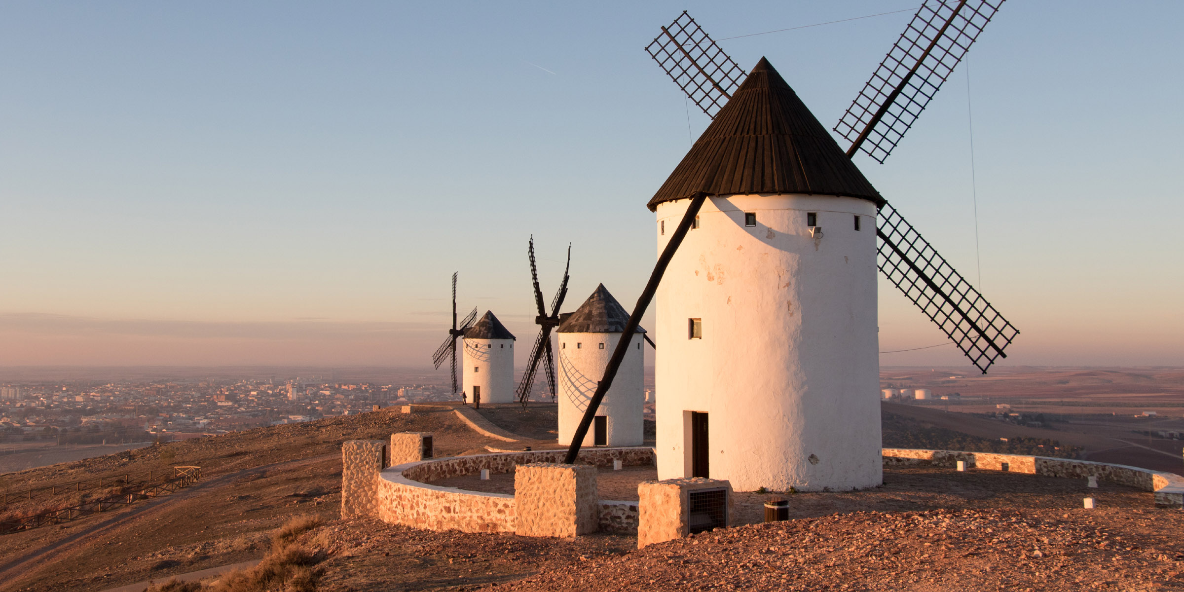


The perfect place to meet the spirit of Don Quixote. The route will guide riders through the land of windmills starting in Sierra de la Paz (Campo de Criptana) where ten of them were in use till the 50s and three of them have been declared Cultural Heritage because of their antiquity. They date back to the 16th century and they keep their original mechanisms. To preserve the machinery, the Mills work every Saturday.
Riders will continue south to the windmills of Alcazar de San Juan a municipality and city located in the northeast of the Ciudad Real province, in the autonomous community of Castilla-La Mancha. There are four windmills: Rocinante, Barataria, Fierabrás, and Barcelona. The last windmill in Alcázar de San Juan stopped working in 1939.
Further west riders will reach Herencia. The town is located on part of the eighth stretch of Don Quixote’s route. Windmills are placed on each of two medium-sized hills found behind the village. The first windmill was built in 1790. Eleven mills were counted in 1807. Currently stands the beautiful image of seven mills with their names: El Ama, La Sobrina, Dulcinea, Maritones, La Dueña Dolorida, La Duquesa and Teresa Panza.
“It seems to me that you aren’t well-versed in adventures—they are giants; and if you’re afraid, get away from here and start praying while I go into a fierce and unequal battle with them.” Miguel de Cervantes Don Quixote
CP 10: Pico del Veleta


Pico del Veleta is located in the Sierra Nevada mountain range in Andalucia. Veleta is a 42-kilometer-long Europe’s highest cycling climb. The total altitude gained during the climb is nearly 2,700m more than twice the ascent of Tourmalet!
30km into the climb you will reach the barrier at Hoya de la Mora, which is where the professional cyclists turn around and start their descent! But there is another 12km to climb to the checkpoint at 3,398m.
CP 11: Tarifa


At exactly 36 degrees latitude, the Punta de Tarifa is the southernmost point of continental Europe. This coastal town is located on the Strait of Gibraltar where the Atlantic and Mediterranean meet. Tarifa takes its name from an 8th-century military commander named Tarif ibn Malik. Tarifa’s key architectural attraction is the Castle of Guzman El Bueno. It was built on the orders of the Caliph of Córdoba in the 10th century, to protect this strategically located town against invaders from both north and south. Tarifa is the biggest hot spot for kite surfing in all of Europe.
The distance between Tarifa and Morocco is only 14 kilometers! You can see Africa from here! The view is even more captivating at night! The water reflects the light from Tangier and other coastal towns. There is something phenomenal about looking across the sea to another continent!
Tarifa is the place to finish, with plenty of cheap but good options for accommodation, a chilled and relaxed café, and bar culture in the old town, blue skies, beach, and warm sea. The perfect place for a few days of recovery.
Photos: From past NorthCape-Tarifa editions, cycle touring and route scouting by Andy Buchs. A handfull photos (CP1, CP3 and 1st CP9) legally acquired. Riders on the photos: Christopher Ross Bennett, Javier Simon, Andrej Zaman, Boris Pupič, Tanja Hacker, Matti Ainasoja, Roberto de Osti, Dani, Irena Sosinska