Heading SouthWest
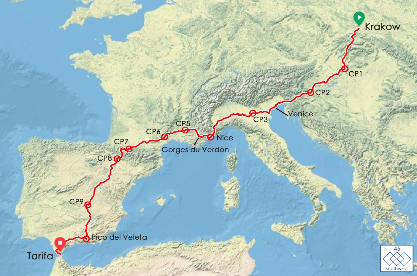
45-SouthWest is a given road route, starting in Krakow Poland, in the center of Europe, heading southwest to the most southern point of European mainland, Tarifa.
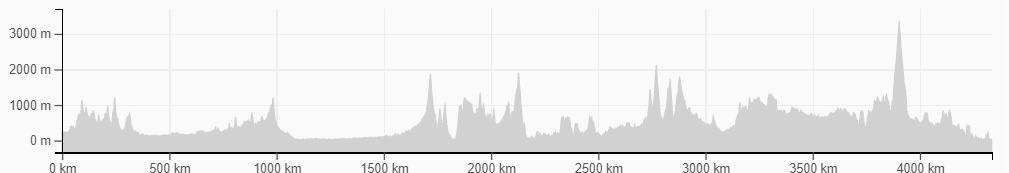
| Distance: | 4384km |
| Checkpoints: | 11 mandatory checkpoints (finish included) |
| Countries: | Poland, Slovakia, Hungary, Slovenia, Austria, Italy, France, and Spain. |
| Roads characteristics: | Paved roads, some short sections of unpaved roads are part too. The unpaved sections are ridable on a road bike without any problems. |
Riders can choose between 3 finishing points:
- Nice, France – 1888km
- Pico del Veleta, Spain – 3952km
- Tarifa, Spain – 4384km
The route profile delivers 50,000 vertical meters. 3 mountain ranges are part of the course, the Alps, the Pyrenees and the Sierra Nevada. The Tatra mountains we pass just in the west. The highest route point is with 3,398m the top of Pico del Veleta. Between the mountains, the route is flat and fast.
Following remarkable mountain passes are part of the route:
Sella Nevea, Col de Tende, Col de Braus, Col d’Aspin, Col du Tourmalet, Col du Soulor, Col d’Aubisque, Frontera del Portalet.
The route is subject to change.
The official GPS file and the route book will be available 4 weeks before the start.
Beside the checkpoints and many beautiful stretches, Col de Tende and Gorges du Verdon are certainly some of the most spectacular sections on the route.
Col de Tende


Col de Tende (Colle di Tenda) is an international high mountain pass at an elevation of 1.876m above sea level, located on the border between France and Italy. It’s one of the most hairpinned roads in the world. Originally it featured 48 hairpin turns. The 3km long Tende tunnel was built in 1882, taking all the traffic away from the top part of the road. It’s reputed to be one of the most ancient roads in Europe, laid down by the Phoenicians and later used by the Greeks who had colonized Marseille and, after them, the Romans. In 1860 when the county of Nice became French, the upper Roya Valley (Tende, la Brigue) remained Italian.
The relationship between the 2 countries became tenser at the end of the 19th century and forts were built on both sides of the border. The forts at the Col of Tende were therefore built by Italy. The Central fort is surrounded by 5 other fortifications, all of them built between 1881 and 1883. A cable car brought the supplies in winter when the forts could not be reached. It started in Panice, on the Northern side. The forts were not used during WWI, with France and Italy being allied then.
Gorges du Verdon – the deepest canyon in Europe


Located in French Provence, Alpes-de-Haute-Provence department. It starts downstream after the town of Castellane and ends near Moustiers-Sainte-Marie in the Lac de Sainte-Croix reservoir. The turquoise river Verdon flows through the approximately 21 km long and up to 700 meters deep canyon. The entire area where the gorge is right now used to be underwater.
This is about 250 million years ago. Verdon Gorge has five different hydroelectric dams that were constructed between 1929 and 1975. Verdon Gorge has striking turquoise-green water. This is caused by the tiny rock particles known as glacial flour. When it mixes with microscopic algae in the water, it gives out that color. The river got its name from the green color of the water.
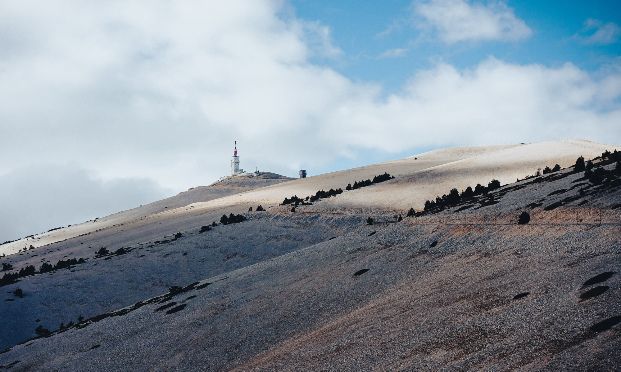
Photos: From route scouting by Andy Buchs.